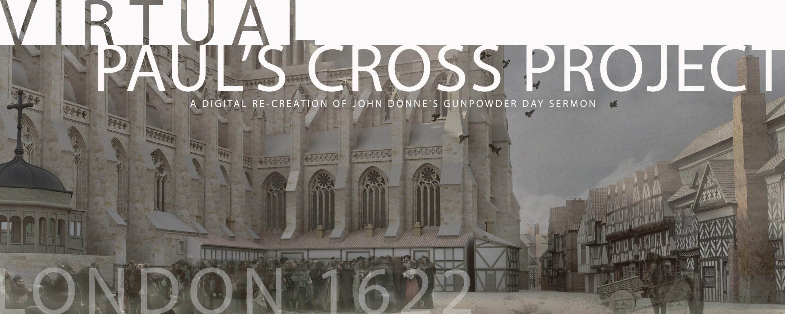
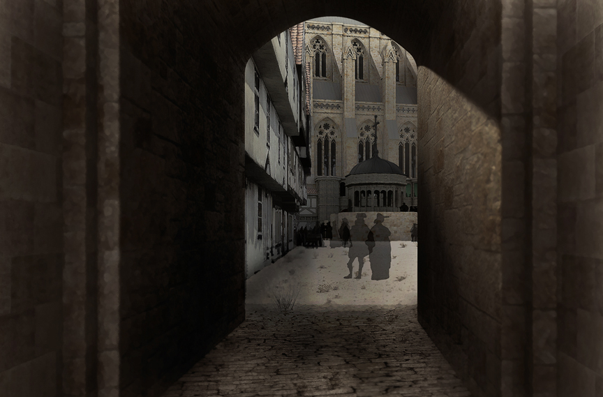
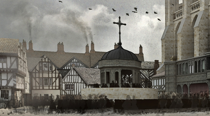
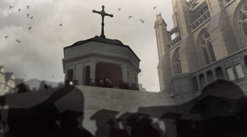
Figure 1: Paul’s Churchyard, the Cross Yard. From the Visual Model, constructed by Joshua Stephens.
EXPLORING THE VISUAL MODEL
The Virtual Paul’s Cross Project depicts the north-east corner of Paul’s Churchyard, including the Choir and North Transept of the Cathedral, the Paul’s Cross Preaching Station, and the buildings surrounding the Churchyard, chiefly mixed-use houses with retail book shops on the ground floor and living accommodations above.
The model also includes the buildings along the streets that run alongside the northeast corner of the Churchyard, specifically Paternoster Row to the north and The Old Change Street to the east, as well as their intersection at the west end of Cheapside Street.
The model was created in Google SketchUp by Joshua Stephens, a graduate student in architecture in the College of Design at NC State University.
This is how a portion of the model looks as constructed:
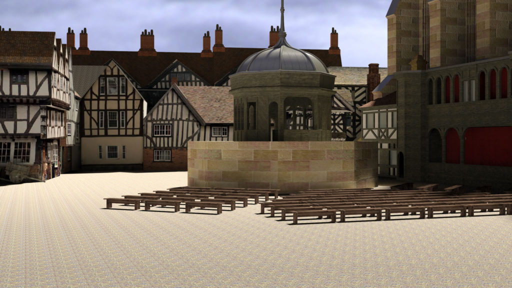
Figure 2: Paul’s Churchyard, looking east, from the west. From the Visual Model, constructed by Joshua Stephens.
Images from the SketchUp model were then rendered and imported in to Photoshop by Jordan Gray, also a graduate student in architecture in the College of Design at NC State University. Jordan added detail and shading to the model to give the appearance of Paul’s Churchyard on the morning of November 5th, 1622, when the sun was low and the light dim.
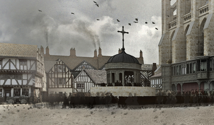 Figure 3: Paul’s Churchyard, looking east, from the west. From the Visual Model, constructed by Joshua Stephens, rendered by Jordan Gray.
Here is a view of the rendered model from essentially the same perspective as the image at the top of this page.
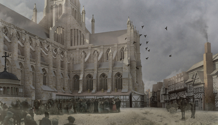
Figure 4: Paul’s Churchyard, the Cross Yard. From the Visual Model, constructed by Joshua Stephens, rendered by Jordan Gray.
The Churchyard was dominated to the south and west by the Choir at the east end of the cathedral, constructed in the Gothic style during the 13th century to replace an earlier Choir in the Romanesque style, and the north transept, constructed in the Romanesque style between 1100 – 1200.
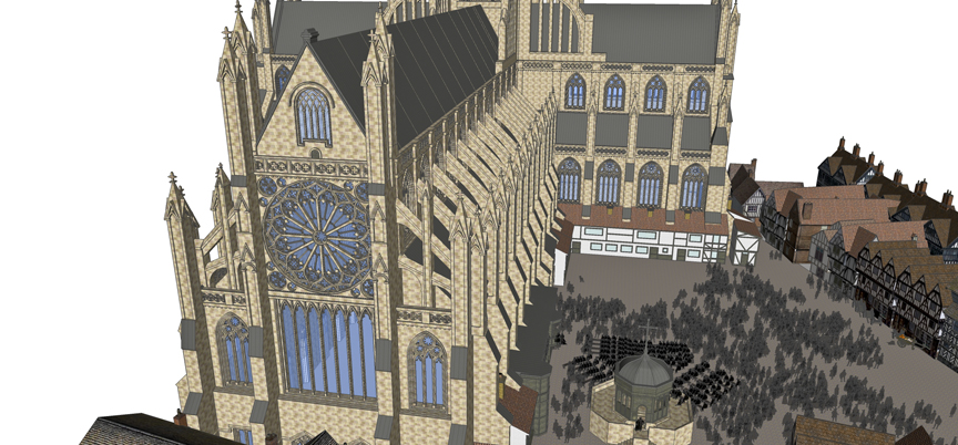
Here is an overhead view of the basic model from the east, highlighting the Great East Window of the cathedral.
Figure 5: St Paul’s Cathedral and Paul’s Churchyard, overhead view from the east. From the Visual Model, constructed by Joshua Stephens.
Across the churchyard to the north and east were mixed-use structures built in the Churchyard in the 16th and early 17th centuries. These structures, as well as the structures that were built against the North Transept of the Cathedral, chiefly housed shops used by London’s booksellers to market their wares.
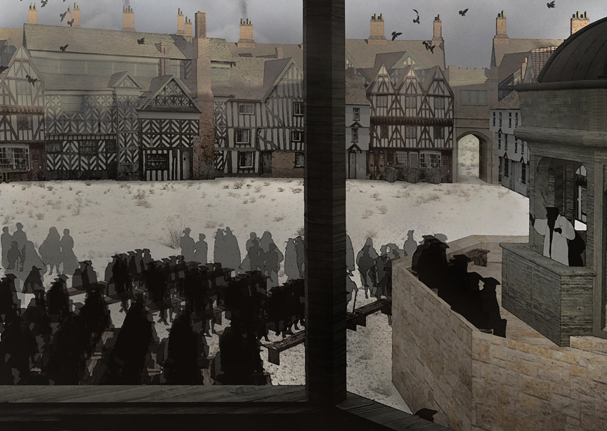
Figure 6: Paul’s Cross, from the Sermon House. From the Visual Model, constructed by Joshua Stephens, rendered by Jordan Gray.
The brick structure directly opposite the east end of St Paul’s is St Paul’s School, an institution founded by John Colet while he was Dean of St Paul’s (1505-1519) which later would support the education of generations of Englishmen, including John Milton.
Access to this part of the Churchyard was from a series of gates that gave access to the Churchyard from the streets surrounding the Cathedral.
To the north east, giving access from the intersection of Paternoster Row and Cheapside was Paul’s Gate.
Figure 7: Paul’s Gate. From the Visual Model, constructed by Joshua Stephens, rendered by Jordan Gray.
Other gates or passageways gave access to the Churchyard. Entry from Old Change and Watling Street to the east was through Augustine’s Gate, just off the south east corner of the Choir. Access from the west, off Creed Lane and Ave Maria Lane was through Ludgate, the great gate to the Churchyard. Access from the south, from Carter Lane, was through a passageway called Paul’s Chain.
The Churchyard itself was an irregular rectangle, measuring roughly 250 feet from east to west and roughly 185 feet from north to south.
The surface of the Churchyard was earth, packed down by the passage of thousands of people making their way across the Churchyard, either to hear sermons at Paul’s Cross, to attend services inside the cathedral, or to join the throng in Paul’s Walk, the infamous area inside the cathedral’s nave. This part of the Churchyard was still being used as a burial site well into the 17th century.
The central structure in this section of Paul’s Churchyard was, of course, the Paul’s Cross Preaching Station, situated approximately 40 feet from the north wall of the Choir and 145 feet from the book shops to the north, and approximately 150 feet from the east wall of the north transept and 100 feet from St Paul’s School to the east.
Figure 8: Paul’s Cross, from 50 feet. From the Visual Model, constructed by Joshua Stephens, rendered by Jordan Gray.
There had been a structure at this site since the 13th century but the Preaching Station reconstructed in this Project was the work of Thomas Kempe, Bishop of London, who ordered the construction of the Preaching Station, made mostly of wood but with a lead roof, approximately 17 feet across, and resting on a stone foundation approximately 35 feet across.
Figure 9: Paul’s Cross from 25 feet. From the Visual Model, constructed by Joshua Stephens, rendered by Jordan Gray.
Before Donne became Dean of St Paul’s, the structure had been augmented with the addition of a wall in front of the site where the preacher stood that supported a raised platform providing seating for a number of people who had the clearest view and best opportunity to hear what the preacher had to say.
By the seventeenth century, benches, presumably stored in the cathedral when not being used in the Churchyard, were set up to provide seating for a at least, but perhaps more than, 250 people. These benches were available for rent. Contemporary accounts speak of patrons who sent their servants to the Churchyard early to secure seating for their masters.
